

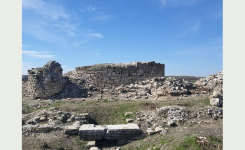
Turnu Fortress
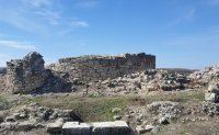
Turnu Citadel lies southwest of Turnu Măgurele, near the Danube and the mouth of the Olt. Archaeological research dates the medieval fortification to the fourteenth century. Its position in the floodplain of the two rivers explains the importance of this control point on the edge of Wallachia. Today visitors can see the surviving remains of the fortification.
The stone walls and the lines of the enclosures show the outline of the old fortress. In the central area, the remains of the tower that gave the place its name can still be made out, and archaeological research has documented several stages of use. The site is outside the urban center, so a visit to the citadel needs to be planned separately from the walk through Turnu Măgurele.
Photo: Ptlpq / Wikimedia Commons, CC BY-SA 4.0. Resized to fit 650 × 400 px. The adaptation is distributed under the same license. Photo from 2019.